The Shape of Water: How the Movement of Oceans Impacts Human Activity
Helen Czerski Explores the Shape-Shifting Science Behind the High Seas
Liquids are shape-shifters. Part of the definition of a liquid is that it takes the shape of whatever container you put it in (which is why there have been occasional investigations into whether cats qualify). The Earth’s gravity pulls liquid seawater towards the center of the planet, and so the ocean has filled the regions of Earth’s surface which are closest to the middle. But for all its lumps and bumps when you’re a puny human, the Earth’s surface is actually very smooth. The distance from the bottom of the deepest ocean trench to the top of Mount Everest is just 0.3 per cent of the radius of the planet. The average ocean depth is a fifth of that: 3.68 kilometers, only 0.06 per cent of the Earth’s radius. To put that into perspective, if you imagine the Earth as an inflated blue party balloon, the ocean depth is equivalent to the thickness of the stretched rubber. But if the Earth’s watery shell is so thin, why does it matter if it’s skinnier in some places and a bit thicker in others? The answer is that the ocean engine is dominated by horizontal motion, by layers of water sliding over each other but staying at the same depth. Anything that pushes a water mass up or down is causing an important shift in the workings of the engine, as we saw with the upwelling off the coast of South America. And of course, if there’s a very large immovable obstacle blocking the way, like a continent, water flowing towards it will have to change direction completely.
If you were looking down on Earth from outer space and feeling mean, you might characterize the ocean as a thin spherical puddle with some bits missing. But the weird shape of the ocean container is what makes the ocean engine interesting: it puts constraints on how the water can move, and this produces glorious variety in the workings of the engine. The ocean shape also isn’t static—the edges are constantly moving as tides and seasons come and go, and the surface wouldn’t be perfectly smooth even if you removed the endless waves ruffling it. So before we can get to the ocean’s internal anatomy, we need to investigate its boundaries—its shape. We’ll start with what we see when we see the sea: the top.
Top
At 3 a.m., the camp started to wake up. I had slept under the stars on the beach, while others roosted on the picnic tables under the local paddling club’s hale (a roof-only hut) or curled up on the ground next to the canoes. The canoes had been rigged the night before, the traditional ropework done by torchlight and then hidden under a modern waterproof cover. At 3.45 a.m. Kimokeo called all forty paddlers into the hale, where both familiar and unfamiliar faces were dimly lit by four electric bulbs. As always before a voyage, all of us joined hands in one big circle. As always, Kimokeo thanked the elders—the kūpuna—and talked about our place between the heavens, the ocean and the earth. He had talked the night before about the principle of a voyage—that it isn’t fundamentally about paddling technique or technical excellence, but about the connections among the crew. A female Hawaiian elder had also spoken: “The ocean can embrace you, and the ocean can break you. When you go into the channel tomorrow, you must go with aloha.” Aloha to the Hawaiians is more than just a greeting. It means love and peace and compassion, and it’s an expression of the most important values of cooperative human existence. Our circle was the physical reminder of our group, our team, and the interdependence of all the paddlers in a canoe. There was a moment of stillness after Kimokeo finished speaking, then a squeeze of hands before the circle rearranged itself to move the canoes to the water and begin the voyage.
It’s easy to forget how recently our mental image of the deep sea was of an empty canvas: a yawning hole of nothingness.
These voyages are a modern expression of old traditions. The focus is the canoe, the vessel that allows you to traverse the ocean using skill and cooperation and connection. It’s the concept that matters, not the material details. So when Kimokeo stands on the pier to sound the conch shell in the darkness, and to receive an answering tone from the gloom, it’s not at all unusual that he’s wearing a bright orange modern lifejacket. He is seventy-two, after all, and his wife insists on it.
We are about to cross from the Big Island of Hawai‘i to Maui, a 56-mile journey when you include following the coast around Maui to our destination, and three six-person canoes will make the crossing. Each canoe has its own support boat which will carry one crew of six while the other six paddle for an hour, and we’ll switch every hour for the whole day. In the dark, I sit at the back of the support boat as it tows our canoe out to the tip of the Big Island, and we arrive there just before sunrise. It’s a stunningly beautiful morning, and as the stars disappear and the ocean turns pink there’s a sudden perspective shift that makes the hairs on the back of my neck stand up. Our familiar human-scale canoe shrinks without warning to become a tiny and insignificant dot against the giant silhouettes of the volcanoes Mauna Loa and Mauna Kea that now dominate the horizon. As the sun rises, the first crew take up their paddles and the voyage begins.
The water between the Big Island and Maui is called the ʻAlenuihāhā Channel by the Hawaiians, a name that translates as “great billows smashing.” The trade winds are funneled though the gap between the islands, creating the fastest winds in Hawaiian coastal waters and a steady army of waves marching towards the west-south-west. The last thing I think before I jump off the support boat to start my first hour in the canoe is that this is an astonishing example of wind-driven breaking waves, the topic I’ve spent ten years studying. There’s a 15 knot wind pushing up 1.5 meter waves which are breaking at the crests and everything is beautifully lined up. I don’t think I’ve ever seen waves this perfect, so regularly spaced and arranged like a textbook diagram. After that, I don’t have time to think about anything for a while.
Switching involves jumping off the back of the support boat into the ocean and then treading water in a line as the canoe comes up to meet the group. The paddlers in the canoe hop out, leaving their paddles behind, and the new crew haul themselves out of the water and into the canoe to replace them, a process which is rarely elegant in open seas. But as soon as everyone is in, you paddle. For this first part of the crossing we are paddling across the wave field, so the canoe is nearly parallel with the wave crests and long ridges of water are continually rising up on my right, temporarily filling my world on that side. The ama, the canoe’s stabilizing second hull, sits out to my left, keeping the canoe upright as we paddle forward. I’m in the second seat from the front, and the paddler in front of me is often paddling in air while a wave rolls underneath, lifting the nose of the canoe from the surface. Then the splash from the nose hitting the water launches over both of us and we dig our paddles deeper. But I don’t care about that. My overriding emotion is a deep, visceral admiration for the canoe. It works. The support boat bounces around, safe in spite of the waves. But this canoe feels far safer because of the waves—because it’s a part of the ocean, glued to it by the six paddles pushing it forward and the skill of the steerer (at the back in the sixth seat) at navigating nature. The hour goes incredibly quickly, and when I get back on the support boat, Mauna Loa and Mauna Kea already seem very far away.
But it’s my second stint in the canoe that brings the real revelation. The canoe has turned now so that it’s running with the waves and the wind. The steerer and the stroke at the front of the canoe are both very experienced Hawaiian paddlers, and it becomes clear that they’re in the canoe for one reason only: to feast on a full hour’s adrenaline rush as the human-plus-canoe-plus-ocean combination hits the peak of its potential. I did not know that being in a canoe could ever be like this. As each wave tilts the canoe, the Hawaiians frantically call “push, push, push,” and the human engine races to stay with the wave as it propels us forward, accompanied by enthusiastic whoops of pure joy which rapidly turn back into calls to push to meet the next wave. There is total focus, no time to think, just another wave and another, and the punishing physical effort required to maintain this state is completely forgotten in the joy of riding with the ocean. I have heard coaches talk about the need for your paddle to connect with the water, but I’ve never felt it like this. My paddle and the other five are holding the canoe and the ocean together, gluing us to the ocean surface to share its energy. The reward for creating that connection is a flood of raw exhilaration and absolute joy in the beautiful things that nature and humans can do together. And it goes on and on…I can feel the ocean through my paddle, a connection that science has never given me, and I can’t get enough of it. When Hawaiians talk about connection to the ocean, the heavens and the earth, they’re not empty words. It’s this experience, in words whose meaning is enriched for ever once you have experienced the raw potential of being part of nature, not opposed to it. When I climb back on to the support boat, after an hour of flying with the ocean, I’m astonished at how much closer Maui is, and how fast we must have been traveling.
The voyage takes nine hours in total, and the conditions do turn against us a bit at the end. But the memory of that downwind section keeps me going through all the rest. When I got out after that second stint, my first words to my coach were: “You never told me a canoe could do that.” He laughed and said: “That’s the drug.” Count me an addict.
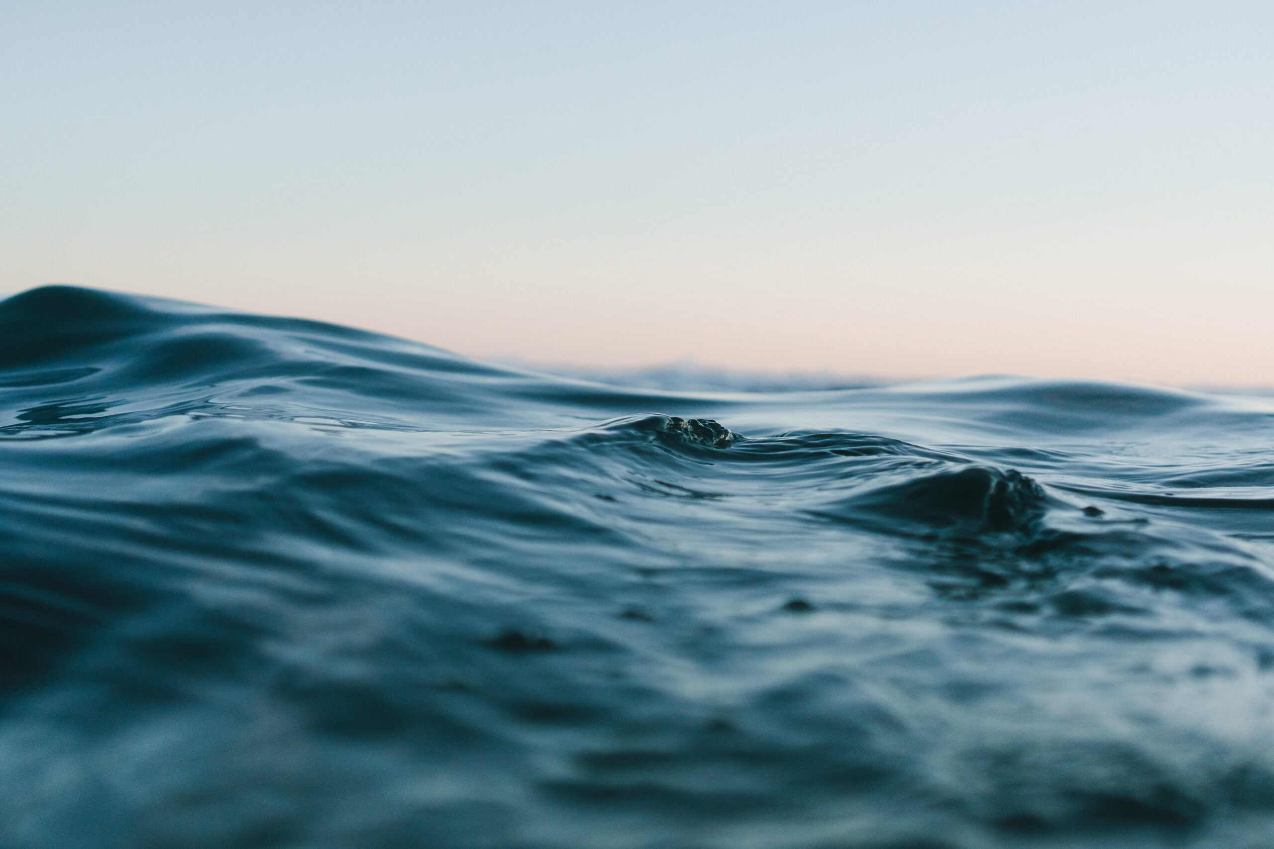
Since waves are temporary and mobile, it may seem odd to treat them as an important part of the ocean’s shape. A huge storm in the middle of the North Atlantic with waves 10 meters high is just lightly dancing on top of an ocean that’s 4 kilometers deep. If you want to play at being Poseidon, pick up your trident, stand in a swimming pool that’s around 1 meter deep and blow gently on the surface to get the tiniest ripple you can manage. That’s approximately the vertical effect of a force ten gale on the shape of the sea surface out in the open ocean. But the shifting shape of waves is active, not passive, and it’s directly connected to the workings of the ocean engine. Waves are a link between atmosphere and ocean. They have also had an outsized influence on human affairs. Every wave has come from somewhere and is on its way somewhere else. Waves are caused by the wind, although the link isn’t always straightforward. That makes life tricky if you want to predict the waves tomorrow or next week, and so for most of human history the arrival of waves was just a lottery. No one really took wave prediction seriously until the Allied forces in the Second World War were on the brink of setting themselves up for catastrophe.
Waves and war
In 1943, a young oceanographer, Walter Munk, was aiding the war effort in Washington DC when he learned of Allied plans to land troops in North Africa. The troops were to be conveyed to the beach in small landing craft which would come into the shore so that the bow of the boat could be lowered, allowing troops to scramble off. The problem was the shifting ocean surface shape: as soon as the waves at the beach reached a couple of meters in height they would push the landing craft sideways and fill them with water. After a bit of research, it became obvious to Walter that waves at the proposed landing site were almost always higher than the safe limit. Unless the landings happened on the small number of calm days, they would be a failure. There were only two routes to a successful outcome: blind luck or a scheme for predicting future waves. No one had tried to predict waves before, and the US Navy wasn’t convinced that it was necessary. Munk consulted with his previous boss Harald Sverdrup, the Director of the Scripps Institution of Oceanography, and Sverdrup thought it was possible. His authority was enough to convince the Navy that the attempt should be made. The only way to make a prediction was to follow the whole journey of the waves, so they began at the beginning.
When you blow on a cup of tea with a smooth, stationary surface, the stream of air pushes downwards on that surface, making a dimple. Surface tension makes the liquid’s surface behave a bit like an elastic sheet, and if you push it rapidly downwards in one place a disturbance will ripple out across the rest of the surface. The very beginning of waves in the ocean is similar, though the downward push doesn’t come from a continuous downward wind. It comes from the ever-shifting swirls of the turbulent air above, which deliver puffs of faster wind and changes in pressure that distort the surface. Once there are ripples, the sideways flow of wind has something to get a grip on, and it pushes on the upwind side of each ripple, forcing the ripple to get bigger and steeper as it grows into a longer-lasting ocean wave. After a while, the ocean surface is a jumble of waves of different sizes, all traveling at slightly different speeds in slightly different directions, and all carrying energy that has been given to them by the wind.
In 1943, Munk and Sverdrup didn’t know any of the details, but they knew that the mixture of wave sizes and shapes depended on the speed of the wind and the distance over which it had been blowing on the ocean (known to oceanographers as the fetch). They could use a weather forecast to predict the waves caused by wind out in the open ocean. But this jumble of waves caused by local wind, called the wind sea, isn’t what was causing problems for the landing craft. The important thing about waves is that they’re a shape that must travel. Once the wind has died down the waves are still there, moving outward across the sea surface and carrying their energy with them. The next stage was to adjust for what happened to the waves between their creation in a storm (which could be hundreds of miles from the wave prediction area) and their arrival at the landing beach. Some of the waves, especially the shorter ones, lost their energy quite quickly. But the longer waves kept going, spreading out and becoming smoother as the small lumps and bumps fizzled out. These long, smooth, leftover waves are known as swell, and they’re often most obvious on days with little wind, because then there’s no wind sea sitting on top of them. They can easily keep going until they reach a coastline. The final stage of Munk’s and Sverdrup’s analysis was to consider what happened at the landing site itself, where the sloping beach makes the waves steeper again just before they break. This last calculation is where the wave height experienced by the landing craft became apparent. The wave prediction model considered each of these three stages separately, and although it was rough and ready, it got the big picture right.
This new method was successfully used to predict calm days for the landings in North Africa, and since the US Navy was now convinced that this might actually be a useful exercise, Munk and Sverdrup established a school for Navy and Air Force officers in La Jolla in California. They kept refining their wave prediction methods as they taught, but the real test was still to come.
As the oceanographers did their calculations, the planet kept turning and the Second World War rumbled on. But the end was coming. Germany had occupied most of western Europe since 1940, and in the early summer of 1944, the Allied forces were ready to launch a huge invasion from the British coast in an attempt to retake that territory. This invasion was code-named Operation Overlord, and the plan depended on a surprise crossing of the English Channel to land 132,000 troops in northern France by ship on a single day, with another 24,000 transported by air. As he watched the debates about the ships needed to do the job, the British Prime Minister Winston Churchill grumbled in his diary: “The destinies of two great empires [are] seemingly tied up in some god damned things called LSTs” (LST stood for Landing Ship, Tank). But those destinies were also tied up in the ocean engine, which controlled the water those ships would have to cross and more importantly, the waves that would be rolling in with the ships as they tried to land. As in North Africa, too much swell would cause huge casualties before the troops ever set foot on land. The best available weather forecasts were sent to Munk and Sverdrup in California and also to the British Meteorological Office, and they made their predictions of the ocean surface shape and what was likely to be happening as the effects of storms from the previous days reached the coast of northern France. The landing also required a full moon, the right tides and favorable weather, so the window of opportunity was narrow. Wave predictions found that on the preferred landing day, June 5, successful landings would be impossible. On the following day, conditions would be “very difficult, but not impossible,” but further delay would miss the window for the tides and the moon. Walter Munk later told colleagues that he understood that the swell forecasts were what persuaded General Eisenhower to delay the landings until June 6, which we now know as D-Day. The ocean waves that could have caused one of the greatest wartime disasters for the Allies rolled in on June 5 to plunge over empty beaches, but after one more rotation of the planet the ocean shape had changed; and so the most decisive amphibious landing in human history had far milder waves to contend with. Progress on the first day was far from ideal, and even the lowered swell caused a fair amount of seasickness in the landing craft, but this invasion marked the beginning of the end of the war. The temporary shape of the ocean surface has real and very practical consequences for human affairs.
But it also has consequences for the ocean engine. As the wind blows across the great expanses of the ocean surface, it is constantly donating energy to waves. The waves lose that energy either gradually over many miles or suddenly when they break. We associate breaking waves with the coast, but most of them are out in the open ocean, providing a route for wind energy that has been converted into waves to shift back again into a tiny amount of ocean heating. The shape of the ocean surface is a temporary energy store, one of many such reservoirs that are constantly being filled and emptied as energy trickles through the Earth system. Munk and Sverdrup’s work formed the foundation of today’s wave and swell predictions, although they both moved on to other fields of study.
The top of the ocean is not flat
If you somehow switched the wind off all around the world so that there was no wave generation, the ocean surface would still have a very distinctive shape. These patterns are too subtle to be seen directly by the human eye, but measurements of the surface shape from precise scientific instruments give us a whole new way to know how the ocean engine is turning. The biggest features are attributable to the variations in gravitational pull from different rocks underneath, and they’re astonishing to contemplate. There’s a 54-meter-high dome in the North Atlantic Ocean surface that’s just over a thousand miles across. There’s also a huge hole 94 meter deep just to the south of India. No one sailing across those areas would ever know—you need satellites to spot fixed features like these—but the ocean is full of them. Mapping of gravity strength and sea surface height can actually be used to work backwards to find the shape of the sea floor; if there’s a big underwater mountain, there’s likely to be a small bump in the ocean surface just above it, as water is gravitationally attracted towards its rocky bulk. This ocean surface shape is independent of waves and currents and weather, and it’s called the geoid.
Suddenly that empty canvas had a character and occupants and mysteries made of substance rather than fantasy.
But when you switch the wind (and therefore also ocean currents) back on in our hypothetical situation, even more lumps and bumps and ridges will appear, mostly less than 1 meter high. These irregularities are far broader than waves—many miles—across—and the waves ride on top of them. Some of them are directly caused by the weather. The center of a big rotating storm in the North Atlantic might well have an atmospheric pressure at the centre which is around 4 per cent lower than the atmosphere outside the storm. That pressure drop is responsible for a significant reduction in the downward push on the ocean surface, which will bulge upwards, forming a dome which is 40 centimeters higher than its surroundings, and which travels along with the storm. It’s not a wave or a tsunami, just a region of ocean which bulges upwards. A bulge of this kind can make the damage caused by waves at a coastline significantly worse, especially at high tide, because the higher sea can reach further inland. And as great currents flow, they also cause ridges in the ocean surface, as the forces tugging sideways on them are balanced by water piling up. This is incredibly useful to ocean scientists, because it means that if you make very detailed satellite measurements of sea surface shape, you can work out where the great (and lesser) ocean currents are flowing. Specialized devices on satellites called altimeters monitor these changes to give us a critical insight into what the ocean engine is doing today or this week.
The surface matters, then; but the overall structure of the ocean engine is dictated by the shape of the sea floor. So let’s leave the surface behind and fall downwards through the darkness, until we land with a gentle bump on the bottom of the ocean.
Bottom
Possibly the greatest tragedy of studying the ocean is that the physics of seawater forbids the grand panoramic views of the sea floor that would give our imaginations a framework to anchor our understanding. Light is absorbed or scattered within a few tens or hundreds of meters, so even if you could floodlight a large area, you could never gaze into the distance and see where you are. Astronauts experience the overview effect, the intense emotional experience that goes with seeing the Earth from space and themselves as tiny specks in orbit around it. We can imagine ourselves in their shoes because we have the photographs they take, and we can immerse ourselves in the visual feast of the curvature of the Earth with an International Space Station solar panel in the foreground. Hundreds of humans have made the trip to the deep sea and they too have brought back astonishing photographs. But the deep-sea images are close-ups: detailed and fascinating rather than grand and perspective-shifting. So the voyage to the lower extremity of the ocean engine is blank in our minds, although this is a dramatic journey to an alien part of our world. What are we missing out on?
“It’s like falling through the stars.” Professor Deb Kelley is sitting in her office at the University of Washington, describing being encapsulated in a submersible descending into the depths. “You’re in a small sphere, it’s dark, and it’s relatively uncomfortable. And it’s super-intense. You don’t have any sense of direction and you don’t have any sense of speed. I spend a large part of the time on the descent with my face crammed up against the window, looking at the bioluminescent critters—I have no idea what they are. And then about 100 meters off the bottom, they turn the lights on. And out here [the coast near Seattle ], you forget you’re in the water because it’s so clear. It’s like flying. But it’s really intense, and that makes it phenomenally exhausting.”
Deb is a marine geologist who has done more than fifty dives in the deep-sea submersible Alvin since the mid-1990s. Her main expertise is in ocean volcanoes and hydrothermal vents, and she has seen with her own eyes what the deep sea floor has to offer. She is softly spoken but enthusiastic, and her office is littered with pieces of rock, including an irregular black glassy chunk about the size of a shoebox with a perfectly circular hole drilled straight through it. She tells me that this is part of a lava flow, taken from the top of an underwater volcano. It sits on the desk in front of me while we talk, glinting in the sunlight, begging questions.
Even after all her decades of studying and visiting the sea floor, Deb gives the impression of still being amazed by what’s down there. She describes a submersible pootling along huge plains that stretch away into the gloom, incredibly flat—”It’s like driving across the floor”—and then the shock of the searchlights meeting a sudden wall, tens of meters high, which marks the start of a volcanic subduction zone. In tectonically active regions, there are arches and columns jutting up from a jumbled and rough base. The remains of lava channels look like emptied rivers. Most dramatic of all are the crown jewels of the darkest depths of the ocean, the deep-sea vents. “They have such a startling amount of color,” Deb says. “There’s bright purples and blues and white, and chimneys that are so covered in animals that you can’t even see the rock.” She keeps coming back to the speed of change in these volcanic areas, and how different the same site looks if you return to it even a few months later. It is the job of science to use quantitative evidence to develop understanding, but it is tales like these—the experience of the deep sea—that has really changed our opinion of it.
It’s easy to forget how recently our mental image of the deep sea was of an empty canvas: a yawning hole of nothingness. Thrilling stories of sea monsters kept ocean storytellers in business, but the ocean itself was less of a place and more of a threat. It’s less than one hundred years since the first voyagers returned from this mysterious realm. Their tales made the deep ocean a real place, and suddenly that empty canvas had a character and occupants and mysteries made of substance rather than fantasy.
__________________________________
Excerpted from The Blue Machine: How the Ocean Works by Helen Czerski. Copyright © 2023. Available from W.W. Norton & Company.
Helen Czerski
Helen Czerski is a physicist and oceanographer at University College London’s Department of Mechanical Engineering. The author of The Blue Machine and Storm in a Teacup, she is a columnist for the Wall Street Journal, writing regularly about the physics of everyday life. She lives in London.


