


Reading the River: How to Measure the Frequency of Flooding
Ellen Wohl Explores How “Flood Fingerprints” Can Help Us Prepare for Future Flood Disasters
Phrases such as “10-year flood” or “100-year flood” are misleading. These terms are abbreviations for probability: a 10-year flood is a volume of flow that occurs on average once every 10 years, based on the records of flow for that stream. If there are only 10 years of record, the size of the 10-year flood is little more than a guess, and there is no reason that two 10-year floods cannot occur in successive years. It would be unusual but not impossible. The larger the flood, the less accurately we can predict how frequently it will occur. Large floods tend to be infrequent, and people tend to have short (a few decades to perhaps a century) records of streamflow. And then there is nonstationarity.
The idea that the past is the key to the present underlies all sciences that deal with time, such as geology, evolutionary biology, and ecology. Scientists cannot directly experience the past, but if I as a river scientist see that a river leaves distinctive layers of sediment where it meanders, and I then find similar layers in sedimentary rocks, I feel justified in interpreting those rock layers as a former meandering river. Stationarity is the mathematical version of this idea.
A series of numbers representing peak annual streamflow over the course of many years will show variation from year to year. If the numbers exhibit stationarity, I can choose any subset of time—say, years 20 to 30 in a 50-year period—and statistical characteristics such as the average or the range between highest and lowest values will not differ significantly from those of any other subset of time. Think of the streamflow values as a regularly fluctuating heartbeat, with no upward or downward trend through time.
Think of the streamflow values as a regularly fluctuating heartbeat, with no upward or downward trend through time.
We assume stationarity when estimating the return period of a flood, but stationarity does not really exist. Why not? First, there are natural fluctuations in climate and precipitation, and these fluctuations create periods of distinctly more or less flooding. If the streamflow record is on the short side, it might capture a particularly wet or dry period. Extrapolating from that period could be inaccurate.
These are not hypothetical scenarios. The most (in)famous example is the Colorado River of the western United States, which supplies water for some 40 million people in the nation, 15 percent of the country’s farmland, and several endangered species. The federal government divided up the river’s flow among competing states (and Mexico) in 1922 based on records of streamflow that covered only a couple of decades. Those happened to be rather wet decades, and more water was allocated to the water users than was actually present in the river during most years. This has only recently become a severe problem, because most of the water users did not request their full allotment…until now.
The second fact that hamstrings the assumption of stationarity is human-caused change. The overarching human-caused change is warming climate and associated changes in precipitation. The Colorado River catchment, for example, is becoming drier and will likely continue to do so, providing even less water with time. Within individual river catchments, changes such as clearing native land cover for agriculture or urbanization alters how precipitation moves into river corridors and can either increase or decrease the size and return interval of floods. Regulations governing flood hazard mapping and flood insurance change much more slowly than scientific understanding, so we continue to rely on estimates of the 100-year flood for zoning and insuring property, even if the magnitude of such a flood has changed with time.
Measuring streamflow through time is one way to estimate flood return interval. People have marked the level of the highest yearly flood for thousands of years along the Nile and along some of China’s great rivers. In most of the world, though, streamflow measurements cover only the past few decades. Fortunately, floods leave all sorts of fingerprints on the stream corridor and scientists got much better at detecting these starting in the 1950s.
What do flood fingerprints look like? Sand and silt that settle from floodwaters in places that smaller flows never reach, such as caves or alcoves along the walls of bedrock canyons. Scars on the trunks of floodplain trees where other wood in the swiftly flowing water smacked into the tree trunk with enough force to damage the bark or even shear off the living tree. (Riverside trees are tough, and some of them can regrow from a bent or shattered trunk.) Abandoned channels that filled with sediment during the flood and then provided germination sites for new trees, creating trees all of about the same age in a portion of the floodplain forest.
Flooding of the magnitude of Hurricane Helene or the Texas storms will occur again and we must be prepared on all fronts if we are to limit loss of life.
To decipher these flood fingerprints, you need to know how big the flood was and when it occurred. “How big” comes from context—how much water is needed to fill this river corridor to a level that would deposit those sediments, damage those trees, or fill that former channel? “When” is derived from tree rings and from radiocarbon ages of charcoal or wood in the flood sediments. Drawing on many lines of evidence, it may be possible to extend the record of floods far beyond direct measurements of streamflow.
The Big Thompson River flows from the continental divide in Colorado eastward to the South Platte on the Great Plains. The river is not actually very big by world standards, but it does have big floods. An intense summer thunderstorm in 1976 created an enormous flood that killed 142 people. The flood was more than four times as large as the largest flood recorded at the river’s gaging station during the 88 years of records. All the descriptions used for big floods appeared—unprecedented, once-in- a- lifetime, and so forth. I suppose it depends on how long your lifetime is. A flood of similar magnitude occurred in the Big Thompson in 2013.
Scientists initially estimated that the 1976 flood was the largest that had occurred since the glaciers retreated 10,000 years ago. In the decades after the flood, studies of tree rings revealed the sequence of wet and dry years and flooding over 400-500 years. Studies of flood sediments revealed the location and size of floods over thousands of years. The estimate for the return interval of the 1976 flood shrank to perhaps 300–400 years. Then, 37 years later, came the 2013 flood, which is now considered the 100-year flood for the Big Thompson. No stationarity here.
Similar questions are now being asked about the July 2025 flooding in the Texas Hill Country that caused such tragic loss of life. Will such an enormous flood occur again? How soon might we expect it? What might we have done differently to better prepare for the 2025 flooding? There are no easy answers to these questions. The flooding was unusually swift and extensive but numerical models of changing climate indicate that the extreme rainfall that caused flooding is likely to become more common in future. We talk of warming climate but we might as well talk about extreme climate that will cause longer and more severe droughts, more intense and prolonged rainfall, more bitter cold, and more scorching heat waves, at different times and in different places.
Flooding of the magnitude of Hurricane Helene or the Texas storms will occur again and we must be prepared on all fronts if we are to limit loss of life: continued funding of climate research and meteorological forecasting, better advanced warning systems, strict enforcement of flood zoning, and individual awareness that we live in a rapidly changing climate.
__________________________________
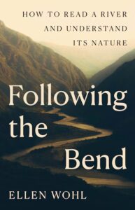
Adapted from Following the Bend: How to Read a River and Understand Its Nature. Used with the permission of the publisher, Princeton University Press. Copyright © 2015 by Ellen Wohl
Ellen Wohl
Ellen Wohl is University Distinguished Professor in the Department of Geosciences at Colorado State University. Her many books include Dead Wood: The Afterlife of Trees, Something Hidden in the Ranges: The Secret Life of Mountain Ecosystems, and Of Rock and Rivers: Seeking a Sense of Place in the American West.