


On Learning About the Enslaved Men Who Dug South Carolina’s Lowcountry Canals
Virginia McGee Richards on the Building of the New Cut Canal
I didn’t intend to spend ten years searching for one man’s name.
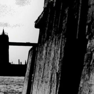
My obsession began in a tidal creek where I went to swim in South Carolina. It was the summer I was pregnant with my fourth child and I longed for a quiet escape from Charleston’s tourist-swarmed streets. Behind Wadmalaw Island, I found a place where I could slip down a mud embankment and lower myself into a canal called New Cut. I became a suspended bather, swimming through water so rich with silt that I couldn’t see below the surface. In this forgotten corner of the Lowcountry, the loudest noise was the chattering and clicking of shrimp singing beneath the surface. As I floated back and forth with the sea tide, I wondered about the canal’s origins. The British colonial name of New Cut was different from other nearby creeks—Wadmalaw, Bohicket, Leadenwah, Stono—all named in Indigenous dialects.
Naively, I thought that discovering New Cut’s origin story wouldn’t require much research grit—especially in Charleston, South Carolina, where history is worshipped. Charleston is filled with libraries and special rooms dedicated to preserving the past in carefully curated collections of diaries, maps, ledgers, and colonial archives. To investigate New Cut, I intended to swing by the local library, look through an index and read a couple of paragraphs about my swimming hole.
But there was no written history of New Cut anywhere.
Librarians advised that few historical records from the area around New Cut had survived centuries of weather, a county courthouse fire, and war. During the Civil War, South Carolina transferred official papers from the Lowcountry, where New Cut is located, to Columbia for safe keeping. Many paper records were burned when General Sherman’s army marched across the state in 1865. A local historian in the Charleston Public Library pointed me toward the bookshelf where French and British maps were kept and suggested that I look there for New Cut’s origins.
*
The absence of a written history hooked me, and my quick trip to the library became a quest. Burning through days that became years in windowless archives, I fed reels of microfilm through a reader and combed through faded documents. Only after thousands of hours of research did I begin to weave together the story of New Cut canal. The few historical documents that I found revealed that my swimming hole at New Cut had been carved from the earth by enslaved Black men. Thumbing through a compendium of old drawings, my first real clue to the canal’s origins was marked on a rare map from 1711. On the map, a surveyor had written “The Cutt” for “New Cut” in the place where I wade into the creek to swim.
The trees stood over Black men burrowing so deeply into the gray marsh that they disappeared into it.
Using the date 1711, I went back in time to the late 1600s and early 1700s to learn that enslaved and indentured men were forced to build New Cut, a mile-long watery traverse through a dense cypress forest. The work required felling primeval trees measuring six feet in diameter and digging a deep trench through the marsh to accommodate boat traffic. During construction, Black men shoveled mud through malarial swamps, while battling snakes and alligators in intense heat. Once created, New Cut allowed colonial travelers to rely on strong sea tides to carry them through the canal.
In the 1700s when the canals of the Inner Passage—New Cut, Haulover Cut, New Town Cut, Wappoo Cut, and Elliot’s Cut— were constructed, Black workers were listed as itemized property. These individuals shaped Charleston’s politics and economy by building canals, roads, bridges, forts— virtually all the colony’s infrastructure—but their contributions were not documented and their names are unknown. Their work, however, has survived in the deep trenches at New Cut which have endured for three hundred years. These six-foot walls of mud engineered to hold tidal water still stand just below the water’s surface.
British plans for a canal system through the Lowcountry were ambitious, and New Cut was only one of dozens of hand-dug waterways. By 1750, enslaved men had constructed a reliable water route extending over three hundred miles from Charleston, South Carolina, to St. Augustine, Florida. This inland route, protected from sea storms and pirates, enabled travelers to journey safely up and down the coast as if on a modern interstate highway. Colonists called the corridor “The Inner Passage” or “The Way Southward.”
Enslaved and indentured people in Carolina used the Inner Passage for their own ends. Subverting Britain’s original intent for the canal system, freedom seekers used the water passage as a route to flee from the colony.
Over a century before the advent of the Underground Railroad to the north, enslaved Carolinians planned and carried out their own escapes by paddling three hundred miles southward on the Inner Passage. Once they reached a Spanish fort at St. Augustine, the Spanish governor freed them if they agreed to convert to Catholicism. Some of these refugees’ expeditions are memorialized in escaped slave notices in a colonial newspaper, the South Carolina Gazette. In 1732, “two Negro Women, one named Delia, having with a sucking Child, and she speaks very little English; and the other named Clarinda” escaped on the waterway in a “Cyprus Canoe about 25 Foot long and 3 Foot wide.” While some escapees traveled all the way to St. Augustine, others navigated canoes into uncharted swamps such as those near New Cut to join maroon communities formed by runaway slaves.
Today it’s possible to experience the Inner Passage by taking a short boat ride southward from Charleston to Kiawah Island. Luxury yachters, kayakers, and recreational fishermen routinely navigate these waterways without knowing their connection to enslavement. To the casual visitor, New Cut Canal appears to be just another peaceful creek, a place where a Charleston resident can cool off and play. But, during my escapes to the water at New Cut, I now know I had been swimming in history. The canals are receding back into native grasslands. Haulover Cut has already fragmented into an unrecognizable jumble of marsh and hammocks behind Kiawah Island. Evidence of the canals and the Inner Passage is rapidly disappearing along with the legacy of the people who built them.
As I walked the canal routes along the coast, I learned to appreciate how easy it is to become disoriented in this watery landscape of undisturbed marsh grass and water extending for miles in all directions. The marsh’s base layer is a heavy dark muck known to locals as “pluff mud.” It is otherworldly: a dark gray glue that pulls off your boot or consumes your whole leg with one misstep. In the blasting afternoon sun, the stench of fermenting earth and decay steams off the marsh. Every hour, this muddy landscape changes as steady tides fill creeks and low basins with seven feet of ocean surge.
A constant in the coastal swamps is the giant heritage trees—live oaks that have lived for hundreds of years along the banks of the Inner Passage. Some of the oldest trees are named, like “Angel Oak,” a thousand-year-old tree in a churchyard. There is something magical about the trees—tourists travel miles to stand under their twisted boughs. Protected by twenty- four-hour surveillance and an eight-foot fence, the Angel Oak draws four hundred thousand visitors each year.
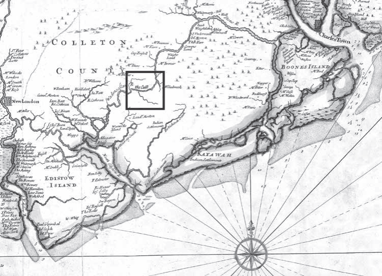 Section of 1711 Edward Crisp Map, “A compleat description of the of the Province of Carolina in 3 parts.”
Over hundreds of years, oaks growing along the Inner Passage absorbed the sight of angled elbows against the land, backs bent, as hundreds of men sacrificed their lives to carve canals from the swamp. The trees stood over Black men burrowing so deeply into the gray marsh that they disappeared into it. There may be no documents in the libraries, but the trees hold bits and shards of this land’s collective memory. The heritage oaks are the last living witnesses to the history of the Inner Passage.
I became a pilgrim at New Cut, returning to walk, and to swim, and to photograph for over a decade in search of clues to the canal’s history. Determined to find the most telling viewpoints, I explored the waterways by foot, boat, and plane. To create the aerial image of the Stono River, I leaned out the window of a 1960s press plane and photographed with my digital camera. The digital file was then converted to a “positive” image on slide film. In the darkroom, an enlarger projected the positive slide onto a glass plate coated with collodion and silver nitrate.
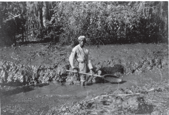 Digging a canal with a wooden shovel at Mulberry Plantation, Charleston, South Carolina, 1916. (Photograph courtesy of Historic Charleston Foundation Archives)
My hope is that images can convey a landscape scarred with secrets, where on rare mornings an ethereal mist rises off fields to meet the certainty of past violence held by the soil. Planting seasons, river baptisms, torture, prayers, African dialects, poverty, massacres, lynchings. The land remembers but cannot speak. By documenting the Inner Passage, I want to give the land a voice.
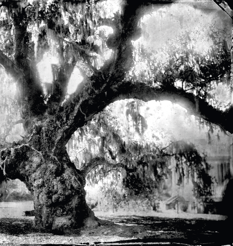 McLeod Oak, James Island. This live oak tree, estimated to be between 300 and 600 years old, stands between former slave dwellings and cotton fields. McLeod Plantation’s cotton crop was loaded onto wooden boats that carried the cotton to market on the Inner Passage.
_______________________________
Excerpted from The Inner Passage: An Untold Story of Black Resistance Along a Southern Waterway by Virginia McGee Richards. Copyright 2026. The MIT Press.
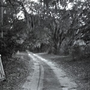
Feature image: New Cut Road, Wadmalaw Island
Virginia McGee Richards
Virginia McGee Richards is an award-winning documentary photographer, historian, and environmental lawyer.