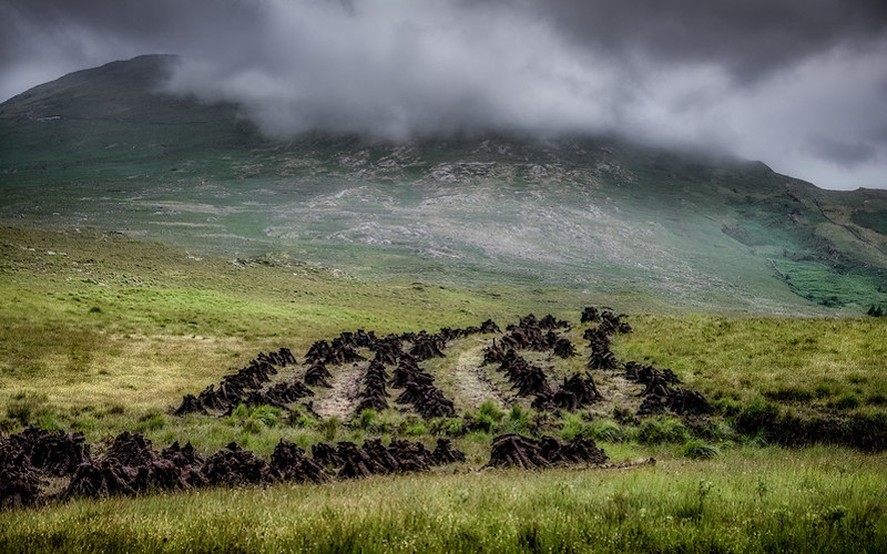
A Cartogropher’s Glorious Paean to the Landscape of Connemara
Tim Robinson on the Lore of Sea and Shore in Ireland
Lingering elegiac evenings of the summer solstice, when the parted day slips behind the mountains to the north like a child hiding behind a sofa, are the best for exploring the valley of Ballynakill Lake. Elements of this little world apart that might not be noticed at other times become quietly insistent on presenting themselves, and those prominent by daylight sink back into obscurity. The roofless gables of the medieval chapel of St Ceannanach (from which the parish is called Baile na Cille, the settlement of the church) are less distinguishable from the dark profiles of trees in the graveyard behind it, whereas by day the ruin, one corner of which touches the roadside wall, seems to rest an elbow on it and lean out like an old farmer eyeing the approaching passer-by; you know you will not get past without having to listen to some inconsequential local history. ‘Did you ever hear of Strong Ned?’ he might say. ‘That’s Éamonn Láidir in Irish. He was an O’Flaherty; his grandfather had the land round here until Cromwell hanged him and gave it to the Martins. Nimble Dick Martin used to come round for the rent with his servants, all armed, and Ned would drive them off all by himself. He was seven feet tall. When he died he was buried just where I’m standing now. People used to come and see his great big bones; they were on show in a sort of shelf in the church wall . . .’
But in the evenings the stories that make themselves heard are less easily understood and of much older origins. At the far end of Ballynakill Lake, which lies at the foot of the meadowed slope south of the chapel and stretches for over a mile to the west, the attention of the belated walker might be caught by two white shapes on a low hillock; at first glance they could be swans asleep. Two stones, in fact, strangely luminous in the gloaming, one of a pyramidal shape and about a yard high, the other a stubby block of the same size but fallen on its side. A little further on a lane leads to the south, climbing around some curious little hills, a moraine left by the glacier that once pushed through the Ballynakill valley to Cleggan Bay. It is because of these hills that the area is called Sheeauns, or Na Siáin, the fairy mounds; they are Sián Fada, the long fairy mound, Sián Mór and Sián Beag, the big and small fairy mounds, Conroy’s Sián, topped by a circular cattle shelter which the long-departed Conroy built up out of the ruins of an ancient ringfort, and Sián na Cuaiche, the fairy mound of the cuckoo. When the crooked thorn trees in the hollows between these hills rake darkness out of the twilight, I have never seen a place more conducive to the fairy faith. The lane continues past a few cottages, then the sound of a stream hidden in an overgrown gully begins to accompany the way, and after a little bridge and a bend to the west, one sees another stone gleaming dimly, a stout pillar about five feet high, among gorse- bushes on a corner of rough land overlooking the stream. What are these ghostly stones that seem to come out at night?
Of course the archaeologists have noted them in all the daylight science can cast on them, and determined that they are Bronze Age monuments, dating from between 2500 and 1000 BC. I will approach the questions of their concentration in the Ballynakill area, their significance to our age, and the less answer- able one of their significance to those who erected them, through an account of my first sight of one of their sort, in the townland of Garraunbawn, another maze of lanes and fields and little hills a mile or so to the east of the old chapel of Ballynakill. At the time of my visit I had already gathered into my mind a number of bits of information about this place, fragmentary but intriguing, like shards of some antique decorated vessel. According to the experts I had consulted at the Ordnance Survey, ‘Garraunbawn,’ the official townland name, is an anglicization of the Irish ‘An Garrán Bán,’ the white or fallow thicket, garrán, a shrubbery or thicket, being a common element in placenames. However, I had also dug out of the OS archives the ‘field name books’ kept by the surveyors who first mapped this area in 1839, and in one of these was a note saying that the Irish name of this place was ‘An Gearrán Bán,’ the white horse. Gearrán, a gelding or small horse, is close in sound to garrán, a shrubbery, and the difference between them—that subtle deflection of the g towards a gy—is lost, like so much else, in anglicization. Further, the old notebook stated that the townland took its name from that of a rock, although it did not record where this rock was. There was also a story I’d heard from a nonagenarian gentleman, formerly of Garraunbawn House, about a white horse that came up out of Garraunbawn Lake; a man caught it and saddled and rode it, and then took the saddle off and hung it over a rock, while the horse galloped away and plunged into the lake again. The mark of the saddle, my informant had heard, was still to be seen on the rock, but unfortunately he didn’t know exactly where this rock was. Another hint had come from an archaeologist who told me that there was a Bronze Age standing stone on the top of a small glacial hill or drumlin in Garraunbawn; in fact such a hill occupies most of the area of the townland.
I remember that it was on a particularly beautiful evening that the thread of my explorations led me through Garraunbawn. I pushed my bike up the lane, sunk between banks rich with wildflowers, that crosses the hill, and just at the top of the slope I glanced through a gap in the hedge. There, in a meadow that fell away towards Ballynakill Bay and the vista of mountains beyond, was the standing stone. It was a stumpy boulder set on end, about five feet high, of milk-white quartz dappled with grey lichen, and in the half-light it looked exactly like the rump of an old white horse, peacefully grazing. I had previously noted a quartz vein exposed on the shore of an island in the bay below, from which big lumps of quartz had rolled out as the coast was cut back by the waves; perhaps some Bronze Age people rafted such a boulder across and lugged it up half a mile of hill to install it here. No doubt until the building of Garraunbawn House in about 1850 it was the most prominent object in the neighbourhood.
In fact I am sure that the stone is the mythical white horse itself, that the surviving version of its story, in which the man hangs the saddle over the stone, is an impoverished one, an attempt to mitigate the magic of an older tale, and that in the eclipsed version the horse was metamorphosed into the stone. So, at that moment, looking through the hedge at the old stone horse cropping the grass on the hilltop, I could tie together a geological and an archaeological strand of Connemara’s prehistory, and follow the efforts of later generations to make sense of that mysterious stone, first by means of a legend of an otherworldly horse, and then by tidying up that story already half forgotten and fossilized in a placename, which itself was later to be misunderstood and gelded by officialdom. For this place is not An Garrán Bán, the fallow thicket, but An Gearrán Bán, named from its ancient, perhaps totemic, white horse of stone, which has been ridden over the millennia by various meanings we can only guess at. The stone itself is as it always was and as a physical object needs no restoration; the restoration of its meaning as a contemporary monument, an icon of the locality’s specificity, is the task of the topographer and a touch in the restoration of our eroded modern consciousness of place. But what of its original significance in the life-world of those who set it up? If anything can be recovered of that, it is only in the context of a wider enquiry into the prehistoric remains of Connemara. At the time of my beginning to map the region the prevailing opinion among archaeologists was that, compared to the riches of the Burren and the limestone plains east of the Corrib, not much was to be expected from these unwelcoming boglands beyond the half-dozen megalithic tombs and a similar number of standing stones recorded by nineteenth-century antiquarians, mainly in the area of Ballynakill. This view was soon to be confounded by the work of the Galway Archaeological Survey team, emanating from the National University in Galway, and in particular the discoveries made by one team member, the indefatigably enthusiastic Clifden archaeologist Michael Gibbons. The synchrony of the Survey’s and my own campaigns in Connemara was productive; all the Survey finds went onto my own map, and the sites that I stumbled across myself or was directed to by local farmers or by placename evidence were all promptly visited, verified and recorded by the specialists. It was an exciting time for me, mentally and physically stretching. One day in the village street of Letterfrack I saw Mike Gibbons sitting in his car wrestling with the big sheets of the 1898 six-inch OS map; he told me that he had heard that turf-cutting had begun in an area of previously untouched bog, and he was off to see if any archaeology had been unearthed. I immediately abandoned the rather tedious sketch-mapping of houses and shops I’d been engaged upon and joined him. We took the main road south- westward for about four miles and left the car in a turf-cutters’ track leading off to the east, in the townland of Crocknaraw (Cnoc na Rátha, the hill of the rath—and we had already checked out the dilapidated little cashel-like enclosure from which it presumably derives its name). After a few hundred yards the track ended in a welter of mud and we turned to climb the small bog-covered hill ahead; I soon diverted to go and talk to some turf-cutters at work nearby, while Mike raced for the summit. Soon he came striding down to tell me that there were white stones up there. We went up together. A fresh turf bank had recently been opened, a trench running across the rounded top of the hill, some six feet wide and a few feet deep, cutting down through the bog-stuff to bedrock—and there, gleaming in its blackish depths, were two massive chunks of white quartz. One stood on end, to a height of about four feet, and the other, a little larger, was prostrate and still partly embedded in the peat. Evidently they had been set up before the bog began to form, and had probably been lost to sight for thousands of years.
Elated by the discovery we looked around us, seeing the countryside as it were through the stones’ eyes. Two miles to the north-east at the head of Ballynakill Bay was Rosleague (in Irish, Ros Liag, standing-stone headland), where we already knew of a standing stone now hidden in recent forestry and a stone pair in a gorse-grown field. In Roscrea a little nearer in the same direction was a well-known standing stone, a thin slab of schist set on edge, while just over a mile to the north was Garraunbawn and its stone. How many such monuments would be visible from the one we were standing by were it not for trees and hedges?
About a mile to our south-west, out in the bog on the further side of the road, was a small drumlin; we ran across and panted up to its summit—and there, just showing through the well-grazed heather and grass, was what looked like the top of a block of white quartz, still entombed in peat. Later on that summer I went up to the top of yet another drumlin three-quarters of a mile to the south of this last, and found the edge of a horizontal slab of rock showing in the side of a new turf bank there, a yard or so below the bog surface, which could well have been a thin standing stone like that of Roscrea, fallen or overthrown during the period of bog growth.
The current reckoning is that, west of the Corrib, there are about eighteen single standing stones like that of Garraunbawn, ten stone pairs like that of Crocnaraw, and five rows of four or more stones, including the prominent ‘Finn Macool’s Fingers’ on a drumlin summit near Tully Cross, and the six-stone row I found on the crest of a moraine in Gleninagh, a valley of the Twelve Pins. A large majority of these single and multiple standing stones are in the north-west of Connemara, roughly between Clifden and Renvyle, and it is now recognized that they amount to one of the richest concentrations of such monuments in Ireland. This area is deeply penetrated by narrow bays reaching to the foothills of the Twelve Pins, cut by the sea into the lowland of soft schists and marbles. These lime-rich rocks, together with the drifts of till raked out of the mountains by the glaciers of the last Ice Age and deposited here, make this the most inviting part of Connemara to settlers; it was so in the late Stone Age and is so today. None of these sites have been excavated or accurately dated, and it is only because of their similarity to datable monuments elsewhere that they are assigned to the Bronze Age; however, studies of the pollen grains preserved in lake sediments in the area point to an increase in clearance, cattle-raising and crop farming in the later Bronze Age, and so it is not unlikely that most of these stones were set up in that period.
As to their purpose, both of the stone rows mentioned above are aligned with dips in the horizon into which the sun appears to set on the shortest day of the year, and no doubt some ceremony was involved in the observation of this phenomenon, which would have been of great practical and spiritual significance. While the standing stones perched on hilltops and glacial ridges, like the two mountain-top cairns also known in this vicinity, may have marked important burials, indicated boundaries or been the focus of religious rituals, their siting primarily suggests the outward gaze from a lofty centre, the eye of dominance—first cousin, I am forced to admit, to the eye of acquisitive enquiry and competitive discovery with which Mike and I swept the landscape that day from the top of Crocnaraw. To me it looks as if the Bronze Age people or peoples took mental command of territory through their highly visible monuments, triangulating their claims as tightly as the ordnance surveyors of the imperialist nineteenth century. If so, there is a sorry connection between the will to power these monuments hint at and the exploitation and depletion of the soil that contributed to the beginning of the formation of bog in about 1200 BC—the slow black tide that would swallow up their sacred stones, not to be revealed again until our own exploitative, turf-cutting times.
But if the world was already old in worldliness in those ancient days, it was as provoked by mysteries as it is still. What did the Bronze Age farmer make of the numerous structures like chambers or tables made of massive slabs of rock, which stood in his fields or by his paths just as one finds them in people’s gardens or behind roadside walls in today’s Ballynakill? In the nineteenth century antiquarians regarded them as druids’ altars, and one or two are marked so, in the evocative Gothic print reserved for ancient monuments, on old Ordnance Survey maps. For country folk such a structure was Leaba Dhiarmada is Gráinne, Diarmaid and Gráinne’s Bed, and everyone knew how Diarmaid ran off with Fionn Mac Cumhaill’s betrothed, Gráinne, and how the tragic couple were hunted all around Ireland by Fionn and his warrior band the Fianna, so that they never slept in the same place twice and built a new bed for themselves every night. That was a legend from Celtic times, the pre-Christian Iron Age, and what theories or stories the Bronze Age, a thousand or more years earlier, had to explain those monuments is of course unknown and unknowable. Unlike the Bronze Age monuments, they occur mainly in valley bottoms and by the seashore, and we now understand them to be Neolithic tombs dating from the earliest days of settled, agricultural society, around 4000 BC.
No fewer than thirty-two such tombs have been found in north- west Connemara, nineteen of them recent discoveries of Michael Gibbons. I visited most of them with the Galway Archaeological Survey team, who were sometimes accompanied by more senior visiting archaeologists such as the late Seán Ó Nualláin of the Ordnance Survey. I became fond of Seán, a plain-spoken, practical- looking and unacademic man, though my first contact with him had not been auspicious. When I was mapping the Burren in 1976, and lugging with me the weighty County Clare volume of the Survey of the Megalithic Tombs of Ireland co-authored by Seán and Professor Ruaidhrí de Valera, I found I had wasted two days crashing around in dense hazel and bramble scrub looking for tombs which according to the map references in this magisterial tome were in certain overgrown fields, whereas in fact they were in certain other overgrown fields nearby. I wrote to the OS about this, and received a polite acknowledgement from Seán, regretting the mistakes and thanking me for my contribution to the pursuit of truth. During the Connemara campaign, Seán told me that he had been a humble clerk in the Ordnance Survey and archaeology had not entered his head until one day he had been detailed to assist ‘this professor fellow’ Dr de Valera with his Megalithic Survey, and found himself travelling round the country visiting every known megalithic tomb in most eminent intellectual company. By degrees he became a collaborator in the work and, after the death of the professor, standard-bearer for the Megalithic Survey and the theoretical classification of tomb types it had developed.
This theory recognized four types of tomb, which in those days were known as court cairns, portal dolmens, wedge-shaped gallery graves and passage graves, and nowadays are more crisply referred to respectively as court tombs, portal tombs, wedge tombs and passage tombs. Newgrange is the supreme example of the last type, with its long passage leading into a burial vault deep within a huge cairn; so far nothing like it has been identified in Connemara, though one or two hilltop cairns might conceal smaller versions. The other sorts of tombs were also originally covered in mounds of clay and small stones, but have largely lost this covering through the centuries of weather, and their now exposed vaults look like more or less collapsed chambers made of boulders and slabs of rock. Court tombs are so called because at one end, usually to the east, of the cairn was a semicircular open area defined by upright set stones, giving access to a vault of one or more chambers. Portal tombs have two tall stones flanking the entrance to the vault, which is usually of one chamber and roofed by a sometimes enormous slanting stone propped on the portal stones and a lower backstone. Wedge tombs have a vault that is wider and higher at the front, invariably western, end. According to de Valera each type is associated with a characteristic range of grave goods and has a particular distribution within Ireland. Court, passage and portal tombs are largely confined to the northern half of Ireland and may represent successive cultural influences or population movements from northern Britain, while wedge tombs are found particularly in the south-west and were considered to have been introduced from Brittany, late in the Neolithic period. Connemara was peripheral to this overview of megalithic culture, the few known wedge tombs there being seen as conforming to ‘rather small and poor types’ constituting ‘a poor coastal diffusion of no great significance.’
The dark hollowness of the tomb under the roadside gorsebush says, ‘There is nobody here, and you shall be nowhere too.’
This fourfold theory did not suit the Young Turks of Connemara excited by the discovery of a number of tombs that the de Valera scheme would relegate to the mongrel or anomalous classes, but that included some impressive and fairly well-preserved monuments. Their own emerging opinion was that the Connemara tombs, in their simplicity, variety and apparently ecumenical intermingling, represented indigenous and early variations of the Neolithic burial-cult, rather than the work of various cultures at various times. The finds of monuments were being paralleled by those of the Galway palaeoecologists, whose studies of the fossil pollen record in the Ballynakill area had revealed the onset and flourishing of settlement and farming during a 200-year period centring on 4000 BC; Michael Gibbons and his colleagues held that the wedges and some small ‘unclassified’ tombs, as well as the court and portal tombs, were built during that early and vigorous phase of the Neolithic. So it was an argumentative occasion when Seán Ó Nualláin was conducted on a tour of the recent discoveries by the Galway team. In the absence of radiocarbon dates or of funds for proper archaeological digs, all depended on visual inspection, mental reconstruction and stylistic categorization of the tombs; in each case the present position of every stone had to be accounted for in terms of the original form of the tomb and its mode of collapse. Seán was particularly physical in this exercise of the imagination; to see him miming the manhandling of a leaning pillar of stone back into what he thought should be its rightful place was to see the tomb builders themselves at work. Whether he succeeded in propping up the fourfold theory, I am not so sure. The final out- come of the Survey, the Archaeological Inventory of County Galway, employs the standard categories, listing twelve court tombs, four portal tombs and six wedge tombs for Connemara, sharing out eleven question marks among these determinations and noting that in a number of instances ‘the classification lines are blurred’ and that others ‘cannot be considered as classic examples of their category’; another nine tombs, most of them robbed beyond recall of their stones, are left unclassified. Connemara has shaken but not yet overthrown the fourfold dogma, I think.
But however vague their theoretical status, the cumulative psychic presence of the tombs in Ballynakill is massive. Some, like the court tomb near the shore west of Cleggan House, with its thick tortoise-backed roof stone, on stubby stone legs, or the unclassified tomb on the opposite shore of Cleggan Bay in Knockbrack, which has a rather narrow roof stone eight feet long delicately poised, as if about to take flight, on the points of its few remaining uprights, stand in open land but seem to disassociate themselves from their surroundings and yearn towards the western sea horizon. Others have to be sought out in fields and thickets; one probable portal tomb in Ballynew, by the road that leads towards the chapel of Ballynakill, crouches as if it were seeking shelter under a gorse- bush behind the roadside wall, and the casual passer-by would not know it is there—but step over the wall and down into the hollow of the field, and the dozy weight and resigned slant of its displaced roof stone leaning against the darkly cavernous chamber will make you remember its presence next time you go by. Those who brought these great stones together thought much about death; they perhaps debated as to whether entrance to the house of death should be from the east or the west, that is, how the cycle of life and death interlinks with those of the sun, stars and moon. These were collective burial places; none of the Ballynakill tombs have been excavated, but else- where similar tombs have been found to hold the cremated remains, or in some cases the disarticulated bones, of a number of persons. The grave goods interred with them—pottery, tools, ornaments— indicate a belief in an afterlife in which such things would continue to be goods. Only the great would be accommodated so grandly and at such expense of communal effort. What of the common people? Their traceless burial places must be all around us, in every ditch and field and the foundations of our houses. Thousands of years of impious robbery and mindless weather have undone the forethought for survival of even the rich and famous. The dark hollowness of the tomb under the roadside gorsebush says, ‘There is nobody here, and you shall be nowhere too.’
Perhaps the Bronze-Agers saw things differently from their Stone Age ancestors and placed their trust in monuments to life rather than death. They practised unobtrusive single burials; a Ballynakill farmer has shown me a box made of stone slabs, big enough to hold a crouched body, which had been torn open by a JCB in the side bank of a newly dug roadway—a Bronze Age ‘short cist.’ In general their standing stones are not known to be associated with death. At least some of the alignments of several boulders, and perhaps of the stone pairs, point out the midwinter sunset, but this event marks the winning-through to the halfway mark in the survival of the season of shortage, a cause of celebration. The quartz stones, which seem to radiate light and call attention to themselves from afar, may have been as territorial as birdsong: ‘We are triumphantly here; this hilltop and this lowland it oversees are ours.’ And sometimes in the hush of midsummer half-light the glimmering stones of Ballynakill whisper to the imagination, ‘You cannot see us, but we are still here.’ Ghosts and fairies are moods and modes of one’s feeling for the Earth; they wax and wane with our desires and delusions. The glimmer of white quartz, dim afterlife of its daytime brilliance, may persist throughout a long summer evening, but will succumb to the black rainy nights after Hallowe’en.
__________________________________
Excerpted from The Last Pool of Darkness. Used with the permission of the publisher, Milkweed Editions. Copyright © 2023 Tim Robinson .
Tim Robinson
A cartographer and writer, Tim Robinson studied mathematics at Cambridge and then worked for many years as a teacher and visual artist in Istanbul, Vienna and London, among other places. In 1972 he moved to the Aran Islands. In 1986 his first book, Stones of Aran: Pilgrimage, was published to great acclaim. The second volume of Stones of Aran, subtitled Labyrinth, appeared in 1995. He has also published collections of essays and maps of the Aran Islands, the Burren, and Connemara. Connemara: Listening to the Wind, first published in 2006, won the Irish Book Award for Non-fiction. Connemara: The Last Pool of Darkness followed in 2008. Since 1984 Tim Robinson has lived in Roundstone, Connemara.


